

Exploring the Eruption History and Volcanic Activity of Atitlan Volcano
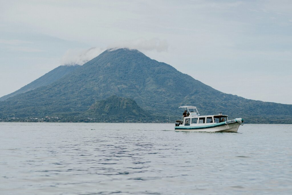
Atitlan Volcano is one of Guatemala’s most breathtaking natural landmarks. Rising proudly to 3,535 meters (11,598 feet) above sea level, this towering stratovolcano dominates the southern shore of the stunning Lake Atitlán. Its symmetrical shape and lush slopes make it a must-see destination for travelers, while its history of eruptions and ongoing activity continue to capture the attention of scientists and adventurers alike.
In this guide, we’ll explore the fascinating eruption history of Atitlan Volcano, its current volcanic activity, and the monitoring efforts in place to ensure local safety. We’ll also share how you can visit this remarkable site with help from Tropicana, your trusted tour operator in Guatemala.
A Volcanic Giant in the Heart of Guatemala
Atitlan Volcano sits within the Sierra Madre mountain range, part of the Pacific Ring of Fire. A region known for frequent volcanic and seismic activity. It’s surrounded by two other volcanoes, Tolimán and San Pedro, forming one of the most photogenic landscapes in Central America.
Beyond its visual appeal, Atitlan Volcano holds great geological importance. Its eruptions over the centuries have shaped the region’s terrain, soil, and ecosystem. Understanding its volcanic behavior provides valuable insight into Guatemala’s rich natural history and helps predict future activity.
A Look Back: The Eruption History of Atitlan Volcano

Atitlan Volcano’s recorded activity stretches back several centuries, with eruptions that significantly influenced the landscape and nearby communities. These historical eruptions offer clues about the volcano’s patterns and potential behavior in the future.
1. The 1469 Eruption
The 1469 eruption is one of the earliest known events in the volcano’s history. Although it occurred long before modern documentation, geological studies reveal that it was a powerful and destructive episode.
This eruption likely unleashed pyroclastic flows—fast-moving clouds of hot gas, ash, and volcanic debris—that reshaped the nearby terrain. The force of the eruption may have affected local vegetation and early settlements, leaving behind layers of volcanic material that still enrich the soil today.
Even centuries later, this prehistoric event reminds us of the immense energy that lies beneath Atitlan’s calm surface.
2. The 1853 Eruption
Another major eruption took place in 1853, marking one of the last significant explosions in Atitlan Volcano’s recorded history. During this period, locals witnessed ash plumes and lava flows that spread across the volcano’s flanks, transforming the landscape and creating new rock formations.
The ashfall affected nearby communities, damaging crops and altering soil composition. For months, farmers struggled to recover from the effects of the eruption, which disrupted agriculture and air quality.
Although more than a century has passed since then, this event remains a key reference point for modern volcanologists studying Atitlan’s behavior.
Current Activity: Signs of a Living Volcano
While Atitlan Volcano hasn’t erupted in recent decades, it’s still considered active. Scientists continue to monitor it closely for signs of potential movement or pressure changes deep within the Earth’s crust.
The volcano exhibits seismic activity, gas emissions, and ground deformation, all of which indicate that it’s very much alive beneath the surface.
Seismic Activity
Volcanologists monitor earthquakes and tremors around Atitlan Volcano. These movements often serve as early warnings of rising magma or shifting underground pressure. Even small tremors are recorded and analyzed to detect patterns that could signal future eruptions.
By studying seismic data, scientists can issue timely alerts to local authorities and residents, helping them stay prepared for any changes in volcanic behavior.
Gas Emissions
Atitlan Volcano releases sulfur dioxide, carbon dioxide, and water vapor, which are measured using advanced instruments. An increase in gas emissions can signal that magma is moving closer to the surface.
Monitoring these gases helps researchers understand the volcano’s internal processes and provides valuable data for predicting possible eruptions.
Ground Deformation
Changes in the volcano’s shape—known as ground deformation—are another vital sign of activity. Scientists use GPS and tiltmeters to detect even the smallest bulges or cracks. These shifts often occur when magma builds up below the surface, putting pressure on the surrounding rock.
Monitoring Efforts: Keeping Communities Safe
Monitoring Atitlan Volcano is a continuous effort involving both national and international organizations. Their goal is to ensure that residents and travelers stay safe while living near or visiting this active volcano.
INSIVUMEH
The National Institute for Seismology, Volcanology, Meteorology, and Hydrology (INSIVUMEH) plays a leading role in tracking volcanic activity across Guatemala. The institute operates observation stations around Atitlán that record seismic data, gas levels, and surface changes.
Their dedicated team of experts analyzes this data daily to provide accurate updates and early warnings to communities and tourists.
International Collaboration
INSIVUMEH works closely with global partners such as the United States Geological Survey (USGS) and other volcanology institutions. These collaborations allow Guatemalan scientists to access cutting-edge technology and share valuable research insights, improving overall monitoring accuracy.
Community Involvement
Local communities near Atitlan Volcano are also key participants in safety and monitoring efforts. Residents receive education on recognizing signs of volcanic activity and practicing emergency procedures.
Regular drills help ensure that families can respond quickly in case of an eruption. This community-based approach strengthens preparedness and builds resilience.
Early Warning Systems
Modern early warning systems combine data from seismic sensors, gas detectors, and satellites. When unusual activity is detected, alerts are issued through radio, television, and mobile networks, giving people enough time to evacuate safely.
Preparedness and Safety Measures
Living near an active volcano like Atitlán requires constant readiness. The Guatemalan government and local authorities have developed comprehensive emergency plans to protect communities in case of future eruptions.
Evacuation Plans
Evacuation routes and temporary shelters are clearly marked in towns surrounding the volcano. Regular community drills help residents practice what to do if an eruption occurs, ensuring quick and safe evacuations.
Public Education
Ongoing public awareness campaigns inform residents about the risks of living near Atitlan Volcano. They teach essential safety tips—such as preparing emergency kits, creating family communication plans, and knowing where to find official updates.
Infrastructure Support
Authorities continue to invest in maintaining roads, communication systems, and rescue resources. These improvements are vital for rapid emergency response and recovery in the event of volcanic activity.
Visiting Atitlan Volcano: A Natural Wonder to Explore
Despite its volatile nature, Atitlan Volcano remains a popular travel destination in Guatemala. Its hiking trails lead through lush forests, volcanic rock fields, and breathtaking viewpoints overlooking Lake Atitlán and its neighboring peaks.
Visitors often describe the experience as both thrilling and peaceful. An adventure that connects them with Guatemala’s raw natural beauty.
If you’re planning to visit Atitlan Volcano or other incredible sites like Acatenango or Pacaya, Tropicana can make your journey seamless.
We offer:
- Guided volcano tours, including Acatenango and Pacaya hikes
- Reliable shuttle services across Guatemala, including to Lake Atitlán
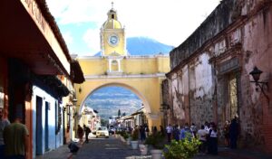
- Comfortable accommodations in Antigua Guatemala—perfect for relaxing before or after your adventure
At Tropicana, we specialize in creating unforgettable travel experiences for adventure seekers. Whether you want to witness an active lava flow or enjoy serene lake views, our team is here to help you explore safely and comfortably.
Contact us anytime to plan your Guatemalan adventure!
Final Thoughts
Atitlan Volcano is more than just a stunning backdrop to Lake Atitlán. It’s a living symbol of Guatemala’s natural power and beauty. Its eruption history, active geology, and the dedicated monitoring efforts around it remind us how dynamic and unpredictable nature can be.
By understanding and respecting this volcano, both locals and visitors can appreciate its magnificence while staying safe. So, when you’re ready to experience Guatemala’s incredible volcanic landscapes, let Tropicana guide you every step of the way.
 Previous Post
 Next Post